|
|
|
Syria
![]()

Geography
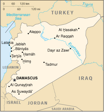
Location: Middle East, bordering the Mediterranean Sea, between Lebanon and Turkey
Geographic coordinates: 35 00 N, 38 00 E
Map references: Middle East
Area:
total: 185,180 sq km
land: 184,050 sq km
water: 1,130 sq km
note: includes 1,295 sq km of Israeli-occupied territory
AreaŚcomparative: slightly larger than North Dakota
Land boundaries:
total: 2,253 km
border countries: Iraq 605 km, Israel 76 km, Jordan 375 km, Lebanon 375 km, Turkey 822 km
Coastline: 193 km
Maritime claims:
contiguous zone: 41 nm
territorial sea: 35 nm
Climate: mostly desert; hot, dry, sunny summers (June to August) and mild, rainy winters (December to February) along coast; cold weather with snow or sleet periodically hitting Damascus
Terrain: primarily semiarid and desert plateau; narrow coastal plain; mountains in west
Elevation extremes:
lowest point: unnamed location near Lake Tiberias -200 m
highest point: Mount Hermon 2,814 m
Natural resources: petroleum, phosphates, chrome and manganese ores, asphalt, iron ore, rock salt, marble, gypsum
Land use:
arable land: 28%
permanent crops: 4%
permanent pastures: 43%
forests and woodland: 3%
other: 22% (1993 est.)
Irrigated land: 9,060 sq km (1993 est.)
Natural hazards: dust storms, sandstorms
EnvironmentŚcurrent issues: deforestation; overgrazing; soil erosion; desertification; water pollution from dumping of raw sewage and wastes from petroleum refining; inadequate supplies of potable water
EnvironmentŚinternational agreements:
party to: Biodiversity, Climate Change, Desertification, Hazardous Wastes, Nuclear Test Ban, Ozone Layer Protection, Ship Pollution
signed, but not ratified: Environmental Modification
GeographyŚnote: there are 42 Israeli settlements and civilian land use sites in the Israeli-occupied Golan Heights (August 1998 est.)
People
Population: 17,213,871 (July 1999 est.)
note: in addition, there are about 37,200 people living in the Israeli-occupied Golan HeightsŚ18,200 Arabs (16,500 Druze and 1,700 Alawites) and about 19,000 Israeli settlers (August 1998 est.)
Age structure:
0-14 years: 46% (male 4,032,620; female 3,840,431)
15-64 years: 51% (male 4,515,274; female 4,322,415)
65 years and over: 3% (male 246,812; female 256,319) (1999 est.)
Population growth rate: 3.15% (1999 est.)
Birth rate: 36.95 births/1,000 population (1999 est.)
Death rate: 5.4 deaths/1,000 population (1999 est.)
Net migration rate: 0 migrant(s)/1,000 population (1999 est.)
Sex ratio:
at birth: 1.05 male(s)/female
under 15 years: 1.05 male(s)/female
15-64 years: 1.04 male(s)/female
65 years and over: 0.96 male(s)/female
total population: 1.04 male(s)/female (1999 est.)
Infant mortality rate: 36.42 deaths/1,000 live births (1999 est.)
Life expectancy at birth:
total population: 68.09 years
male: 66.75 years
female: 69.48 years (1999 est.)
Total fertility rate: 5.37 children born/woman (1999 est.)
Nationality:
noun: Syrian(s)
adjective: Syrian
Ethnic groups: Arab 90.3%, Kurds, Armenians, and other 9.7%
Religions: Sunni Muslim 74%, Alawite, Druze, and other Muslim sects 16%, Christian (various sects) 10%, Jewish (tiny communities in Damascus, Al Qamishli, and Aleppo)
Languages: Arabic (official); Kurdish, Armenian, Aramaic, Circassian widely understood; French, English somewhat understood
Literacy:
definition: age 15 and over can read and write
total population: 70.8%
male: 85.7%
female: 55.8% (1997 est.)
Government
Country name:
conventional long form: Syrian Arab Republic
conventional short form: Syria
local long form: Al Jumhuriyah al Arabiyah as Suriyah
local short form: Suriyah
former: United Arab Republic (with Egypt)
Data code: SY
Government type: republic under military regime since March 1963
Capital: Damascus
Administrative divisions: 14 provinces (muhafazat, singularŚmuhafazah); Al Hasakah, Al Ladhiqiyah, Al Qunaytirah, Ar Raqqah, As Suwayda', Dar'a, Dayr az Zawr, Dimashq, Halab, Hamah, Hims, Idlib, Rif Dimashq, Tartus
Independence: 17 April 1946 (from League of Nations mandate under French administration)
National holiday: National Day, 17 April (1946)
Constitution: 13 March 1973
Legal system: based on Islamic law and civil law system; special religious courts; has not accepted compulsory ICJ jurisdiction
Suffrage: 18 years of age; universal
Executive branch:
chief of state: President Hafiz al-ASAD (since 22 February 1971); noteŚPresident ASAD seized power in the November 1970 coup, assumed presidential powers 22 February 1971, and was confirmed as president in the 12 March 1971 national elections; Vice Presidents 'Abd al-Halim ibn Said KHADDAM (since 11 March 1984) and Muhammad Zuhayr MASHARIQA (since 11 March 1984)
head of government: Prime Minister Mahmud ZUBI (since 1 November 1987), Deputy Prime Ministers Lt. Gen. Mustafa TALAS (since 11 March 1984), Dr. Salim YASIN (since NA December 1981), and Rashid AKHTARINI (since 4 July 1992)
cabinet: Council of Ministers appointed by the president
elections: president elected by popular vote for a seven-year term; referendum/election last held 8 February 1999 (next to be held NA 2006); vice presidents appointed by the president; prime minister and deputy prime ministers appointed by the president
election results: Hafiz al-ASAD reelected president; percent of voteŚHafiz al-ASAD 99%
Legislative branch: unicameral People's Council or Majlis al-shaab (250 seats; members elected by popular vote to serve four-year terms)
elections: last held 30 November-1 December 1998 (next to be held NA 2002)
election results: percent of vote by partyŚNPF 67%, non-NPF 33%; seats by partyŚNPF 167, independents 83; noteŚthe constitution guarantees that the Ba'th Party (part of the NPF alliance) receive one-half of the seats
Judicial branch: Supreme Constitutional Court, justices are appointed for four-year terms by the president; High Judicial Council; Court of Cassation; State Security Courts
Political parties and leaders:
National Progressive Front (NPF) includes: the ruling Arab Socialist Renaissance (Ba'th) Party [Hafiz al-ASAD, president of the republic, secretary general of the party, and chairman of the National Progressive Front]; Syrian Arab Socialist Party or ASP [Ghassan 'Abd-al-Aziz UTHMAN]; Arab Socialist Union or ASU [Fayiz ISMAIL]; Syrian Communist Party or SCP [Yusuf FAYSAL]; Arab Socialist Unionist Party [Safwan QUDSI]; Socialist Union Democratic Party [Ahmad al-ASAD]
Political pressure groups and leaders: non-Ba'th parties have little effective political influence; Communist party ineffective; conservative religious leaders; Muslim Brotherhood (operates in exile in Jordan and Yemen)
International organization participation: ABEDA, AFESD, AL, AMF, CAEU, CCC, ESCWA, FAO, G-24, G-77, IAEA, IBRD, ICAO, ICC, ICRM, IDA, IDB, IFAD, IFC, IFRCS, IHO, ILO, IMF, IMO, Intelsat, Interpol, IOC, ISO, ITU, NAM, OAPEC, OIC, UN, UNCTAD, UNESCO, UNIDO, UNRWA, UPU, WFTU, WHO, WMO, WToO
Diplomatic representation in the US:
chief of mission: Ambassador Walid MUALEM
chancery: 2215 Wyoming Avenue NW, Washington, DC 20008
telephone: [1] (202) 232-6313
FAX: [1] (202) 234-9548
Diplomatic representation from the US:
chief of mission: Ambassador Ryan CROCKER
embassy: Abou Roumaneh, Al-Mansur Street, No. 2, Damascus
mailing address: P. O. Box 29, Damascus
telephone: [963] (11) 333-2814, 333-0788, 332-0783
FAX: [963] (11) 224-7938
Flag description: three equal horizontal bands of red (top), white, and black with two small green five-pointed stars in a horizontal line centered in the white band; similar to the flag of Yemen, which has a plain white band and of Iraq, which has three green stars (plus an Arabic inscription) in a horizontal line centered in the white band; also similar to the flag of Egypt, which has a symbolic eagle centered in the white band
Economy
EconomyŚoverview: Syria's predominantly statist economy is on a shaky footing because of Damascus's failure to implement extensive economic reform. The dominant agricultural sectremains underdeveloped, with roughly 80% of agricultural land still dependent on rain-fesources. Although Syria has sufficient water supplies in the aggregate at normal levels of precipitation, the great distance between major water supplies and population centers poses serious distribution problems. The water problem is exacerbated by rapid population growth, industrial expansion, and increased water pollution. Private investment is critical to the modernization of the agricultural, energy, and export sectors. Oil production is leveling off, and the efforts of the nonoil sector to penetrate international markets have fallen short. Syria's inadequate infrastructure, outmoded technological base, and weak educational system make it vulnerable to future shocks and hamper competition with neighbors such as Jordan and Israel.
GDP: purchasing power parityŚ$41.7 billion (1998 est.)
GDPŚreal growth rate: 2% (1998 est.)
GDPŚper capita: purchasing power parityŚ$2,500 (1998 est.)
GDPŚcomposition by sector:
agriculture: 26%
industry: 21%
services: 53% (1997)
Population below poverty line: 15%-25%
Household income or consumption by percentage share:
lowest 10%: NA%
highest 10%: NA%
Inflation rate (consumer prices): 15%-20% (1997 est.)
Labor force: 4.7 million (1998 est.)
Labor forceŚby occupation: services 40%, agriculture 40%, industry 20% (1996 est.)
Unemployment rate: 12%-15% (1998 est.)
Budget:
revenues: $3.5 billion
expenditures: $4.2 billion, including capital expenditures of $NA (1997 est.)
Industries: petroleum, textiles, food processing, beverages, tobacco, phosphate rock mining
Industrial production growth rate: 0.2% (1996 est.)
ElectricityŚproduction: 19.3 billion kWh (1996)
ElectricityŚproduction by source:
fossil fuel: 63.73%
hydro: 36.27%
nuclear: 0%
other: 0% (1996)
ElectricityŚconsumption: 19.3 billion kWh (1996)
ElectricityŚexports: 0 kWh (1996)
ElectricityŚimports: 0 kWh (1996)
AgricultureŚproducts: wheat, barley, cotton, lentils, chickpeas, olives, sugar beets; beef, mutton, eggs, poultry, milk
Exports: $4.2 billion (f.o.b., 1998 est.)
ExportsŚcommodities: petroleum 65%, textiles 16%, food and live animals 13%, manufactures 6% (1997 est.)
ExportsŚpartners: Italy 18%, Germany 13%, France 12%, Turkey 10%, Lebanon 7%, Spain 6% (1997 est.)
Imports: $5.7 billion (c.i.f., 1997)
ImportsŚcommodities: machinery and equipment 40%, foodstuffs/animals 15%, metal and metal products 15%, textiles 10%, chemicals 10%, consumer goods 5% (1997 est.)
ImportsŚpartners: Ukraine 14%, Italy 7%, Germany 6%, Turkey 5%, France 4%, South Korea 4%, Japan 4%, US 3% (1997 est.)
DebtŚexternal: $22 billion (1998 est.)
Economic aidŚrecipient: $327.3 million (1995)
Currency: 1 Syrian pound (ŻS) = 100 piastres
Exchange rates: Syrian pounds (ŻS) per US$1Ś46 (1998), 41.9 (January 1997); official fixed rate 11.225
Fiscal year: calendar year
Communications
Telephones: 541,465 (1992 est.)
Telephone system: fair system currently undergoing significant improvement and digital upgrades, including fiber-optic technology
domestic: coaxial cable and microwave radio relay network
international: satellite earth stationsŚ1 Intelsat (Indian Ocean) and 1 Intersputnik (Atlantic Ocean region); 1 submarine cable; coaxial cable and microwave radio relay to Iraq, Jordan, Lebanon, and Turkey; participant in Medarabtel
Radio broadcast stations: AM 9, FM 1, shortwave 0
Radios: 3.392 million (1992 est.)
Television broadcast stations: 54 (of which 36 are low-power stations and repeaters) (1997)
Televisions: 700,000 (1993 est.)
Transportation
Railways:
total: 1,998 km
broad gauge: 1,766 km 1.435-m gauge
narrow gauge: 232 km 1.050-m gauge
Highways:
total: 41,451 km
paved: 9,575 km (including 877 km of expressways)
unpaved: 31,876 km (1997 est.)
Waterways: 870 km; minimal economic importance
Pipelines: crude oil 1,304 km; petroleum products 515 km
Ports and harbors: Baniyas, Jablah, Latakia, Tartus
Merchant marine:
total: 131 ships (1,000 GRT or over) totaling 401,407 GRT/578,081 DWT
ships by type: bulk 11, cargo 115, livestock carrier 4, roll-on/roll-off cargo 1 (1998 est.)
Airports: 104 (1998 est.)
AirportsŚwith paved runways:
total: 24
over 3,047 m: 5
2,438 to 3,047 m: 16
914 to 1,523 m: 1
under 914 m: 2 (1998 est.)
AirportsŚwith unpaved runways:
total: 80
1,524 to 2,437 m: 3
914 to 1,523 m: 14
under 914 m: 63 (1998 est.)
Heliports: 2 (1998 est.)
Military
Military branches: Syrian Arab Army, Syrian Arab Navy, Syrian Arab Air Force, Syrian Arab Air Defense Forces, Police and Security Force
Military manpowerŚmilitary age: 19 years of age
Military manpowerŚavailability:
males age 15-49: 4,060,995 (1999 est.)
Military manpowerŚfit for military service:
males age 15-49: 2,271,539 (1999 est.)
Military manpowerŚreaching military age annually:
males: 188,546 (1999 est.)
Military expendituresŚdollar figure: $800 million-$1 billion (1997 est.); noteŚbased on official budget data that understate actual spending
Military expendituresŚpercent of GDP: 8% (1995 est.)
Transnational Issues
DisputesŚinternational: Golan Heights is Israeli occupied; dispute with upstream riparian Turkey over Turkish water development plans for the Tigris and Euphrates Rivers; Syrian troops in northern, central, and eastern Lebanon since October 1976
Illicit drugs: a transit point for opiates and hashish bound for regional and Western markets